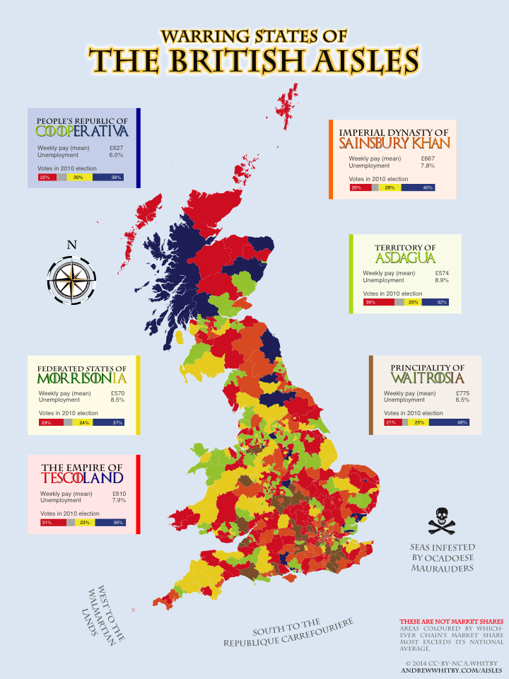
Warring States of the British Aisles
An infographic segmenting Great Britain by local variations in supermarket chains’ estimated market shares. See my blog post on this topic, Taking Supermarket Sociology (a bit) Seriously.
Sources & acknowledgements
Supermarket locations scraped from each chain’s website. The scrapers are hosted on Scraperwiki, so you can download CSV files here (Asda, Co-op, Morrisons, Sainsbury’s, Tesco, Waitrose)
The major assumption for the calculation of market share was “number of retail square feet” per store format. That was based on store websites, annual reports and wikipedia pages. I’ll put that file up, along with my R code, shortly.
The additional data appended is:
-
(Gross) Weekly pay (mean), from the 2013 Annual Survey of Hours and Earnings, accessed via Nomis. I would have preferred to use median but it’s no straightforward when aggregating aggregates, unlike means which can be simply reweighted.
-
Unemployment, from the Sep 2013 Annual Population Survey, also accessed via Nomis.
-
2010 UK Election Results, from the Electoral Commission.
I used MySociety’s excellent MapIt to geocode locations that were not already lat/long tagged. Thanks to Chris Hanretty for a useful lookup file converting between various Westminster Constituency names and codes.